
Via Ferrata Laurenzi was the only iron path in the Rosengarten group I hadn’t done yet. I’ve been putting it off for quite some time, thinking it is too advanced. Last October, five years after my first visit to the Rosengarten group, I finally ticked it off my list. Today, I know that my concerns were unfounded. It wasn’t as hard as I thought it was going to be. In this article, I will cover everything to know about Via ferrata Laurenzi.
Total distance (excl. approach and descent)
5.1 kilometres/ 3.2 miles
Elevation gain (excl. approach and descent)
410 meters / 1345 feet
Difficulty
Advanced (C/D)
Time required
4.5-5 hours


Overview of the via ferrata
Via Ferrata Laurenzi (in German: Laurenzisteig) is a high-alpine iron route that traverses the Molignon ridgeline. The path runs between two alpine huts: Rifugio Alpe Di Tires and Rifugio Antermoia. Both huts are in the Rosengarten Mountain Group in the Italian Dolomites.
The two nearest towns from which you can start your approach to the Via Ferrata Laurenzi are Siusi and Campitello di Fassa.
Via Ferrata Laurenzi is not a long route, but if you add the approach and descent times and distances, you will quickly realise that an overnight stay in a hut is required to tackle it.
TIP: Via Ferrata Laurenzi can be greatly incorporated into a multiday hut-to-hut traverse across the Rosengarten Nature Park. This traverse includes all via ferratas in the Park. Since Laurenzi is the hardest one, I left it for the last day. By then, you should be comfortable using your via ferrata gear and will know whether you are up for something slightly more challenging.
The map & elevation profile
TIP: Hover over the routes to see their names
Important info about the via ferrata
When to go: Mid-June to October
Via ferrata exposition: variable
Map required: Tabacco map no. 029 (Rosengarten) or Tabacco map no. 06 (Val Di Fassa)
Highest point: 2852 meters / 9357 feet
Parking: 1. Siusi gondola. 2. Campitello Col Rodella
Trailhead: 1. Compatsch; 2. Top of Col Rodella
Nearest towns: Siusi, Campitello di Fassa


Getting there
Your journey will depend on which approach route you choose to reach the Alpe Di Tires hut first. You can either start at the top of the Col Rodella Gondola from Val Di Fassa or at the top of the Siusi gondola that runs from Siusi. Both towns can be reached by bus or by car.
By bus
If you start in Siusi and choose option 1 for the approach to Alpe di Tires, you can catch bus no. 177 and get off at the Seis, Kabinenbahn Seiser Alm bus stop. Check for connections on the Süd Tirol Mobil website.
If you start with the Col Rodella gondola in Campitello di Fassa (option 2), you can catch bus no. B101 or B104 and get off in Campitello di Fassa town centre, then walk to the Col Rodella cable car or to the Micheluzzi taxi meeting point. You can check for this connection on the Trentino Trasporti site.
TIP: I usually look for the nearest bus stop by zooming into Google Maps.
By car
If you travel by car, you can leave it at the huge parking lot near the bottom of the Siusi gondola in Siusi (Seis am Schlern)
If you are starting in Campitello di Fassa, leave your car parked at the bottom of the Col Rodella parking lot.
It’s ok to leave cars overnight at both parking lots.
Approach options to the Alpe di Tires hut
Via ferrata Laurenzi starts at the Alpe di Tires hut. Even though it is a relatively short route that can be done in 4-5 hours, you must account for the long approach to the hut as well, before you add the route to your adventure list. Below, I describe a few options to reach the hut.
Option 1: Top of the Siusi gondola to Rifugio Alpe Di Tires across Denti Di Terrarosa saddle
- One way distance: 7.8 km / 4.8 miles
- Elevation gain: 657 m / 2154 feet
- Elevation loss: 63 m / 208 feet
From the town of Siusi, take the Alpe di Siusi Gondola up to Compatsch. From there, follow path number 7, then path number 2. The total time to reach the rifugio from Compatsch is 2,5 hours one way.
Option 2: Top of the Col Rodella cable car to Rifugio Alpe Di Tires
- One way distance: 11.8 km / 7.3 miles
- Elevation gain: 430 m / 1413 feet
- Elevation loss: 443 m / 1454 feet
A slightly longer but more scenic route leads from the top of the Col Rodella gondola, which runs from Campitello di Fassa in the Fassa Valley. This route passes the beautiful Rifugio Sassopiatto. This is a good route if you want to start and end in the same town without repeating any of the trails. A part of this approach intersects with the Sassolungo Circuit hike.
Stages of the via ferrata
Approach: Alpe Di Tires to the start of cables (45-60 minutes)
Leaving Alpe Di Tires hut, head South on path no. 3A in the direction of Forcella Molignon & Passo Principe Hut. The path starts with a steep ascent, with cables installed to assist hikers.
Follow the path until you reach a fork. A left turn will take you onto a zigzag path. About 45 minutes after leaving the hut, you will reach the first cables of the Laurenzi via ferrata. It’s time to put on your gear.
Via Ferrata Laurenzi – Molignon rigdeline traverse (2.5-3 hours)
The first section of the via ferrata is straightforward and follows a well-protected path to the ridgeline. Once you reach it, the trail follows a broad plateau, where no scrambling is involved. There is a great rest area on the plateau with benches carved out of tree trunks and a wooden book where you can carve your name.
Sit down for a few minutes and enjoy the great views of Sassolungo, Mount Antealo, Mount Pelmo, and the Dolomites’ highest peak, Marmolada. Before the trip, download the Peak Finder app on your phone. It’s my favourite tool for checking out all the peak names.
Gradually, the ridgeline becomes narrower, and the challenge begins. The rest of the ridgeline traverse will involve plenty of ups and downs. As daunting as it may sound, the footholds and cable protection are excellent, and we didn’t have any troubles en route. After about 2.5 hours of following the ridgeline, you will reach its highest point—Molignon Di Dentro (2865 meters)
Descent to Lake Antermoia (1h15 to 1.5 hours):
The last part of Via Ferrata Laurenzi involves a downclimb to Antermoia Valley. Right towards the end, the most challenging part was a sharp descent through a loose scree gulley. That’s where you will get the first glimpse of the turquoise Antermoia lake. Once you reach the valley bottom, it is a 15-minute hike to the Antermoia hut.


Exit route from Rifugio Antermoia
Grab a lunch at the Antermoia hut to regain strength for your return. If you are doing the Rosengarten traverse, this is where you will stay your last night. Otherwise, choose from the return routes below.
Option 1: Return to Rifugio Alpe di Tires
- Distance: 6.9 km / 4.3 miles
- Elevation gain: 490 m / 1610 feet
- Elevation loss: 550 m / 1800 feet
If you stay at the Alpe di Tires hut the night before, you can ask the staff to leave some of your things there so you can do Via Ferrata Laurenzi with only the essentials in your backpack. This will make your trip a lot more enjoyable.
After completing the via ferrata, you can return to the Alpe Di Tires hut on a hiking path that runs parallel to the Laurenzisteig. Once back at the hut, you can either return to Compatsch and take the return gondola down to Siusi or stay another night in Rifugio Alpe Di Tires.
TIP: Stay two nights in Alpe Di Tires and tackle Via Ferrata Sentiero Massimiliano the next day.
Option 2: Return to Campitello di Fassa via Duron Valley
- Distance: 9.7 km / 6 miles
- Elevation gain: 80 m / 262 feet
- Elevation loss: 1150 m / 3770 feet
Take this route if you hiked to Alpe Di Tires Hut from the top of the Col Rodella gondola and want to return to Campitello Di Fassa. After completing Via Ferrata Laurenzi, follow the signs to Rifugio Micheluzzi and then down to Campitello Di Fassa.
TIP: There is a shuttle service at Rifugio Micheluzzi that takes passengers down the gravel road to Campitello di Fassa. This will halve the distance of the descent route. You can read about it on the hut’s website.
Overnight stay & dining possibilities
There are plenty of huts along the way, where you can stay overnight or stop for lunch. The best option is to base yourself at Rifugio Alpe Di Tires. The second best is Rifugio Antermoia. Additionally, you will also hike past Rifugio Sassopiatto when hiking from the Col Rodella Cable car. On the exit route to Campitello di Fassa, you will come across Rifugio Micheluzzi.
Where to stay nearby
If you would like to discover the wonders of the Rosengarten Nature Park in the Dolomites, I recommend choosing the Fassa Valley as your base. Canazei, Campitello or Vigo di Fassa are just some towns in the valley, and they all lie within a few minutes’ drive of one another. Here are a couple of my recommendations for hotels in Val Di Fassa
Best Value
Self-catering apartments are only a 10-minute walk from the centre of Canazei in the Fassa Valley.
Top Rated
Locanda degli Artisti Art Hotel
This lovely hotel has a fantastic bar and restaurant. It is a great place for art lovers, and the hotel boasts some quirky art decorations.


Other activities nearby
Hikes
- Sassolungo Circuit
- Piz Boè Summit
- Sella Group Traverse
Travel resources for the Dolomites
Shop my via ferrata gear essentials

Black Diamond Helmet
Rockfall is a significant concern on via ferrata routes. Unbeknownst to you, other climbing groups above you may accidentally dislodge a small rock and send it down the mountain. If it hits you on the head, it could have serious consequences. A helmet on your head (not inside your backpack) is necessary.
Shop on: Amazon (Worldwide) / Backcountry (US)

Black Diamond Momentum Harness
Another must-have on a via ferrata route is a climbing harness. A harness works as an anchor point for your via ferrata lanyard. Try it before your trip to ensure it fits snugly without limiting your movements. Aim for a lightweight harness that will be comfortable to wear between the cable-protected sections when hiking.
- Shop Women’s on Amazon (Worldwide) / Backcountry (US)
- Shop Men’s on Amazon (Worldwide) / Backcountry (US)

Edelrid, Camp or Black Diamond Via Ferrata Lanyard
A via ferrata lanyard connects the climber and their harness to the cables along the route. Its two arms and a hidden extra coil work as an energy absorption system in case of a fall. The two carabiners at the end of the lanyard clip into the cable. Make sure the carabiners are equipped with the palm squeeze mechanism. It’s the safest and most comfortable.
Shop on Amazon (Worldwide) / Backcountry (US)

Black Diamond Crag Gloves
The gloves protect your hands from cuts and scratches you may otherwise get if you haul yourself on the cable without them. I prefer full-finger gloves for extra protection against blisters. If your hands sweat quickly, go for the fingerless version.
Shop on: Amazon (Worldwide) / Backcountry (US)

Salewa Wildfire Edge Approach Shoes
This is my go-to pair of hiking shoes for more accessible trails or via ferrata, where I don’t need extra ankle support. They provide excellent grip on the rock and are very durable.
Shop on: Amazon (Worldwide) / Backcountry (US)
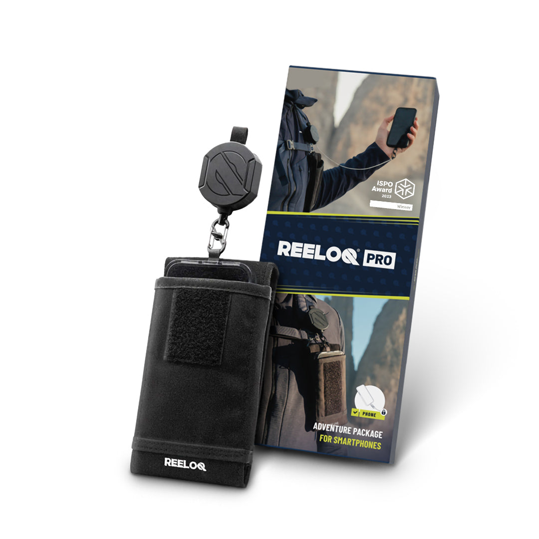
Reeloq Smartphone Securing System
If you want to take great photos on a via ferrata without worrying about losing your phone, Reeloq is the best tool for it. It’s a smartphone-securing system that allows you to use your phone on any adventure. This has been a great addition to my tool arsenal.
Shop on: REELOQ
Support my website!
Hi Reader! If you found any of my articles about the Dolomites useful please consider using the affiliate links below (at no extra cost) when booking your holiday. Thank you
- Reserve your hotel with Booking.com
- Book your rental car with Discover Cars
- Buy your outdoor gear with Backcountry.com (US readers)
If you have any questions, leave them in the comments below!
Hi Marta,
Your website is truly a godsend for me – planning a Rosengarten circuit with my two boys this summer. I have a question – we are doing a mixture of regular hikes and via Ferrata’s over the 5 days 4 nights. We are currently staying in the following Rifugio
Nite 1) Rifugio Fronza Alle Coronelle Nite 2) Rifugio Re Alberto Nite 3) Rifugio Antermoia
Nite 4) ???? – my question is where would you stay the last night before going back down to Bolzano or Siusi? I tried to get a bed in Rifugio Alpe di Tires but they are fully booked. Thank you, Gavin
Hi Gavin. Thanks for the great feedback. You could either stay extra night in Rifugio Antermoia and on day 3 do Via ferrata Laurenzi in reverse. This VF can be done in both directions. This would be a nice option as you would be going lightweight with the essentials. Option two (if Laurenzi sounds too hard) would be to hike from Antermoia to Alpe Di Tires (ca. 2 h), do via ferrata Sentiero Massimiliano (with all your gear) and on decent instead of returning to Alpe Di Tires you continue to Schlernhaus. I hope that helps!
Thanks for the review! 2 questions:
1. I see this is rated 4c, and you mention it is advanced. My partner and I are new to Via Ferrata but are experienced lead climbing (trad and sport) in the USA. I see 4c is equivalent to 5.6/5.7 YDS, would you say that is accurate?
2. Could you do Laurenzi in the other direction (Antermoia to Alpe di Tires), or strongly recommend against it?
Hi Benjamin. Via ferratas are scrambling routes, not climbing. The hardest via ferrata should be easier than the easiest climbing route (maybe some really extreme ones rated E/F will compare to climbing routes, but I have never done those). I have zero climbing experience and I tackle the advanced routes without a problem so that should give you a good idea. Now for the direction, yes they can be done in both directions (both ways you have to climb up on down on a few sections). Have fun!