
One of the first via ferratas I added to my Dolomiti bucket list because of a photograph I saw online was the via ferrata Oskar Schuster. After a week-long marathon of iron paths in the Rosengarten mountain group, I gathered whatever strength and determination I had left and tackled the via ferrata Oskar Schuster before the fast-approaching winter would cut off access to it.
Total round-trip distance
12.2 kilometres/ miles
Elevation gain/loss
740 meters (2430 ft) / 1230 m (4030 ft)
Difficulty
Intermediate (C)
Time required
6.5 – 8 hours


Overview of the via ferrata
Via Ferrata Oskar Schuster is located in the Sassolungo Mountain Group. It starts at Passo Sella, a high mountain pass that connects two famous valleys in the Italian Dolomites: Val Gardena and Val Di Fassa. The route leads to the top of Sassopiato Peak. You can reach the Sella Pass from either valley. The driving time is similar (between 20 and 30 minutes). The route was named after a famous German mountaineer.
While this is an intermediate via ferrata, it is important for me to mention that there are some stretches of exposed and unprotected scrambling along the route, so you must be free of vertigo to be able to enjoy this route. The combination of cables, scrambling, narrow gullies and exposed rock makes it feel more like a genuine mountaineering route. And the setting beneath Sassolungo and Sassopiatto is absolutely spectacular.
The map & elevation profile
Important info about the via ferrata Oskar Schuster
Even though the Sassolungo gondola already runs from the end of May (you can check the exact dates here), you may want to hold off a bit until at least the third week of June to avoid any remaining snow fields. The heart of the Sassolungo group doesn’t see much sun, and there are quite a few narrow gullies where snow may remain late into the season. I did this route at the start of October and already had some fresh snow in places.
When to go: End of June to the first week of October
Via ferrata exposition: east
Trail numbers: 525, 527, 557
Map required: Tabacco Map no. 06 (Val di Fassa)
Highest point: 2950 meters / 9678 feet
Parking: 46.50933, 11.75766
Trailhead: Toni Demetz Hut
Nearest towns: Canazei in Fassa Valley or Selva in Gardena Valley


Getting there
There are various ways to reach Passo Sella, depending on where you are staying. If your base is in the Gardena Valley, you can either take a bus or drive on the windy road. If you are starting from the Fassa Valley, you can also take the Cable Car up.
By bus
You can travel to Passo Sella by public bus from Val Gardena or Val Di Fassa. The bus stop’s name is Passo Sella (Selva di Val Gardena), Rifugio Passo Sella. This might be a good option for those who are uncomfortable driving on the windy, narrow mountain roads in the Dolomites.
TIP: Check the local Sued Tirol Mobil website for bus timetables and prices.
By car
It’s best to type “Passo Sella Dolomiti Mountain Resort” into your GPS. The hotel is right next to the Sassolungo gondola station. There is a decent-sized paid parking lot near the lift.
By cable car
If you are staying in Campitello Di Fassa in the Fassa Valley, you can reach Passo Sella using the Col Rodella Cable Car. From the upper terminal, walk downhill along the wide gravel road for 30 minutes to reach the bottom of the Sassolungo gondola. You will need a return ticket for the Col Rodella Cable Car.
Stages of the via ferrata
Stage 1: Approach from Toni Demetz hut to the start of the cables
- Distance: 3 km (1.9 mi)
- Elevation gain: 270 m (880 ft)
- Elevation loss: 400 m (1300 ft)
- Time required: 1.5 hours
You have two choices once you reach the bottom of the gondola station. One, reserved for the purists, is to walk along path no. 525. The other is to jump onto the ‘coffin’ lift and take yourself to the Sassolungo saddle.
If you choose the first, add 1.5 to 2 hours and 500 meters of elevation gain on a steep scree slope to an already long day. I recommend going with the latter and saving energy for the fun parts. The gondola is open in the summer, from mid-June to the first week of October. You will only need a one-way ticket.
On the top of the Forcella Sassolungo stands the Toni Demetz hut, where you will start your hike. You have just gained 500 meters of elevation from the bottom of the gondola, and I don’t have great news for you. You will now lose most of it.
Follow path 525 through a scree valley, signed for the Rifugio Vicenza (Langkoffelhütte). You should reach it in 45 minutes to an hour. At the Vicenza hut, the path splits.
Follow the signs for via ferrata Oskar Schuster up another scree valley parallel to the one you have just descended. You now have a little over 700 meters of elevation to reach the top of the Sassopiatto – the objective for today.
At first, you will be going up an unpleasant scree path until you reach the first cables on your right-hand side. This shouldn’t take longer than 45 minutes from the hut. Once you do, it’s time for some fun.
Via Ferrata Oskar Schuster:
- Distance: 0.6 km (0.4 mi)
- Elevation gain: 340 m (1115 ft)
- Time required: 1 hour
Look out for the red paint marks along the route. They will keep you right on track. The cable protection is excellent, although the exposure is significant in places. You have nothing to worry about if you stay clipped in and watch your steps. In some sections, you will also encounter ladders and iron rods. They help tremendously with tackling the almost vertical walls.
From the top of Sassopiato, you can look down toward Alpi Di Siusi, the famous and iconic photo spot in the Italian Dolomites. To the Southwest is the Rosengarten group, where you can find via ferratas Catinaccio, Sentiero Massimiliano, or Laurenzi, to name a few. Unfortunately, I wasn’t fortunate with the conditions. As soon as we reached the summit, clouds rolled in, and visibility deteriorated.
Descent to Rifugio Sassopiatto
- Distance: 2.5 km (1.6 mi)
- Elevation loss: 590 m (1940 ft)
- Time required: 1 h 20 min

To descend from the peak, follow path no. 527. I recommend purchasing a map to better visualise the whole route from start to finish. The Tabacco map no. 6, which I linked to in the stats, will be perfect, especially if you plan on exploring more of Val Di Fassa.
The scree path no. 527 zig-zags down for about 1 hour to Rifugio Sassopiatto. This is the perfect place to grab lunch and rest before returning to Passo Sella.
Rifugio Sassopiatto to Passo Sella
- Distance: 6 km (3.7 mi)
- Elevation gain: 130 m (430 ft)
- Elevation loss: 240 m (790 ft)w
- Time required: 2 hours

Take the straightforward, gently undulating path 557 from the Sassopiato hut (pictured above). You should return to where you started in about 1.5 -2 hours. This part of the route intersects with the Sassolungo Circuit hike.
The total time required to complete Via Ferrata Oskar Schuster, including the approach and return, is around 6 hours (without breaks). If you decide to walk to Forcella Sassolungo at the start instead of taking the gondola, you should plan to finish in 8 hours.
Overnight stay & dining possibilities
There are a few huts along the Oskar Schuster via ferrata. The first one is the Toni Demetz hut right at the top of the Sassolungo Coffin lift. The next one, where you might want to stop for a short coffee break, is Rifugio Vicenza. It is 1.8 kilometres into the approach hike. Nestled at around 2,250 m in the heart of the Sassolungo Group, Rifugio Vicenza is surrounded by some of the most dramatic scenery in the Dolomites. Unfortunately, the hut was already closed when I did this route at the start of October.
The next one on the list is the fancy Rifugio Sasso Piatto. It lies just at the foot of Sasso Piatto, 6.2 kilometres into the route. The restaurant serves traditional Ladin and regional dishes, including speck and local cheeses, canederli, hearty mountain meals and, of course, apple Strudel, my favourite. In my opinion, this is the best place to stop for lunch after completing the via ferrata.
It is possible to stay overnight in both huts, but prior reservations are required.


Where to stay nearby
The Fassa Valley stretches for approximately 20 kilometres and is dotted with little towns. Where one ends, another one begins. Below are my recommendations for accommodation in Val Di Fassa.
Best Value
Hotel Ladina in Campitello di Fassa
Set in the centre of Campitello di Fassa and just around 200 metres from the Col Rodella cable car, Hotel Ladina is an excellent base for hiking in the Fassa Valley. This family-run hotel combines a warm, welcoming atmosphere with comfortable alpine-style rooms, many of which offer beautiful views of the Sassolungo Group.
Top Rated
Golden Park Resort in Campitello di Fassa
Located just outside the centre of Campitello di Fassa, Golden Park Resort offers a peaceful mountain setting with impressive views, while remaining close to the attractions and activities of the Fassa Valley. After a day in the mountains, you can unwind in the wellness area featuring a heated indoor pool and sauna.


Other activities nearby
Travel resources for the Dolomites
Shop my via ferrata gear essentials

Black Diamond Helmet
Rockfall is a significant concern on via ferrata routes. Unbeknownst to you, other climbing groups above you may accidentally dislodge a small rock and send it down the mountain. If it hits you on the head, it could have serious consequences. A helmet on your head (not inside your backpack) is necessary.
Shop on: Amazon (Worldwide) / Backcountry (US)

Black Diamond Momentum Harness
Another must-have on a via ferrata route is a climbing harness. A harness works as an anchor point for your via ferrata lanyard. Try it before your trip to ensure it fits snugly without limiting your movements. Aim for a lightweight harness that will be comfortable to wear between the cable-protected sections when hiking.
- Shop Women’s on Amazon (Worldwide) / Backcountry (US)
- Shop Men’s on Amazon (Worldwide) / Backcountry (US)

Edelrid, Camp or Black Diamond Via Ferrata Lanyard
A via ferrata lanyard connects the climber and their harness to the cables along the route. Its two arms and a hidden extra coil work as an energy absorption system in case of a fall. The two carabiners at the end of the lanyard clip into the cable. Make sure the carabiners are equipped with the palm squeeze mechanism. It’s the safest and most comfortable.
Shop on Amazon (Worldwide) / Backcountry (US)

Black Diamond Crag Gloves
The gloves protect your hands from cuts and scratches you may otherwise get if you haul yourself on the cable without them. I prefer full-finger gloves for extra protection against blisters. If your hands sweat quickly, go for the fingerless version.
Shop on: Amazon (Worldwide) / Backcountry (US)

Salewa Wildfire Edge Approach Shoes
This is my go-to pair of hiking shoes for more accessible trails or via ferrata, where I don’t need extra ankle support. They provide excellent grip on the rock and are very durable.
Shop on: Amazon (Worldwide) / Backcountry (US)
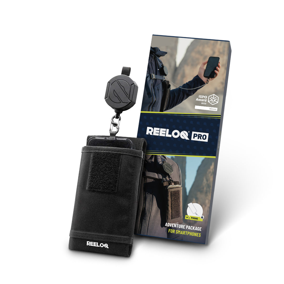
Reeloq Smartphone Securing System
If you want to take great photos on a via ferrata without worrying about losing your phone, Reeloq is the best tool for it. It’s a smartphone-securing system that allows you to use your phone on any adventure. This has been a great addition to my tool arsenal.
Shop on: REELOQ
Hi Marta, I love your blog so much! Thank you for your amazing content. I will be travelling to Dolomites second half of June. We are looking to stay in Val Gardena in a hut and do a one-day Via Ferrata. Currently (from researching your blog) my two options are staying at Toni Demetz and doing the Oskar Schuster Via Ferrata to Sassopiatto OR staying at Tierscher Alpl and doing Massimiliano. We are after an interesting and intermediate Via Ferrata, and also an authentic hut experience. Would you say you have a preference between these two? Alternatively, any other suggestions? Thank you.
hi Ruby. Thanks for your great feedback. Whilst Oskar Schuster is an amazing via ferrata, it does reach almost 3000 meters and it crosses some shaded areas, where snow lingers much longer during the year. Sentiero Massimiliano is a much safer option for this time of the year. Also I prefer Alpe Di Tires to Toni Demetz hut tenfold 🙂 Via ferrata Laurenzi that runs between Alpe Di Tires and Antermoia hut is another great one. I did it in October last year and will be posting a guide for it soon.
Hi! What time of year did you do this ferrata? And did you encounter much snow/ice? Thanks 🙂
Hi Izzy. I did this ferrata in the first week of October on the very last day when the gondola was open. Yes, I did encounter some snow and ice because it snowed the week before when I was doing the Rosengarten Traverse. Most of the snow melted, but it stayed in the shaded gullies. I hope that answers your question