
The dramatic Cadini Di Misurina viewpoint attracts hundreds of tourists daily, but only a few venture beyond it. You can cross the entire Cadini Di Misurina group along the beginner-friendly via ferrata Sentiero Bonacossa. Hint: It leads to one of my favourite huts in the Dolomites.
Total distance
7.6 kilometres / 4.7 miles
Elevation gain
520 meters / 1700 feet
Difficulty
Beginner (A/B)
Time required
4-5 hours


Overview of the via ferrata Sentiero Bonacossa
Via ferrata Sentiero Bonacossa runs between Rifugio Auronzo in the Tre Cime Nature Park and Col De Varda, which lies just outside the park’s border. The route crossed three mountain saddles: Forcella Rinbiano, Forcella del Diavolo (the route’s highest point), and Forcella di Misurina. It’s one of the very few via ferratas in the Dolomites that can be walked in either direction (in this post, I cover the direction from North to South). This is a fantastic half-day outing and a great route to escape the crowds on the famous Tre Cime Circuit trail.
TIP: Via ferrata Sentiero Bonacossa can be incorporated into a 3-4-day Tre Cime Nature Park traverse.
The map and elevation profile of the via ferrata
Important info about via ferrata Sentiero Bonacossa
The route is easy to follow, and the cable-protected sections are not long. The only challenging part was a roughly 15-meter-long downclimb through a tight gully (pictured below). Iron rods have been installed along this section to ease the downclimb. All in all, it is a beginner-friendly via ferrata, perfect for first-timers.
When to go: Mid June – Mid October
Trail numbers: 117, 115
Highest point: 2507 meters / 7766 feet
Parking:
46.57769, 12.25309 Parking 2:
46.58849, 12.25702
Trailhead: 46.61186, 12.29608
Nearest towns: Misurina, Dobiacco, Cortina d’Ampezzo


Getting to the trailhead
Since the via ferrata Sentiero Bonacossa starts and finishes in two different locations, it’s best to leave your car at the bottom of the Col de Varda chairlift, then walk for 20 minutes (1.7 km / 1 mile) along the shoreline of Lake Misurina to the Misurina Genzianella bus stop, then catch the bus to Rifugio Auronzo, where the route begins. That way, your vehicle will wait for you at the finish line.
Alternatively, you can leave your car at the parking lot near the Misurina Genzianella bus stop and walk the distance between the Col De Varda chairlift and the bus stop, after completing the via ferrata.
The Col De Varda chairlift usually runs from the third week of June until the third week of September.
By bus
During summer and early autumn, buses run daily from Dobiacco, Misurina, and Cortina. The bus stop is Rifugio Auronzo. Look for connections on the Süd Tirol Mobil info website.
By car
The last section of the road to Rifugio Auronzo is a toll road, and the parking lot fills up quickly. I do not recommend driving a car. Instead, park your vehicle in either of the two parking lots I marked on the map.


Overnight stay & dining possibilities
Rifugio Auronzo is located at the start of Via Ferrata Sentiero Bonacossa, and quite frankly, I am not a big fan of it. It stands near a massive parking lot where all tourists who come to hike the Tre Cime circuit leave their cars.
Rifugio Fonda Savio lies ca. 4.5 kilometres into the route. This is one of my favourites in the Dolomites, and a nice alternative to Auronzo. Fonda Savio lies along the famous Alta Via 4. For that reason, it books out many months before summer even starts. You can still have a nice meal before continuing the hike.
TIP: One of my favourite via ferratas in the Dolomites, Via Ferrata Merlone, starts near Rifugio Fonda Savio.
At the end of the via ferrata Sentiero Bonacossa, you will find Rifugio Col De Varda. This is where you will need to catch the chairlift down to Misurina.
Where to stay nearby
If you plan to tackle the via ferrata Sentiero Bonacossa, you can stay in Misurina, Cortina d’Ampezzo, or Dobbiaco. Misurina is the closest, but also the smallest. Apart from a few hotels, you won’t find much here. Cortina is a great central hub for exploring the Dolomites. There are many hikes and via ferratas around Cortina that you can tackle (see below for some of my hotel recommendations in Cortina). Dobiacco is located in the Puster Valley in the northern parts of the Dolomites. You will also find many great outdoor activities in Val Pusteria.
Best Value
Top Rated


Other activities nearby
Travel resources for the Dolomites
Shop my via ferrata gear essentials

Black Diamond Helmet
Rockfall is a significant concern on via ferrata routes. Unbeknownst to you, other climbing groups above you may accidentally dislodge a small rock and send it down the mountain. If it hits you on the head, it could have serious consequences. A helmet on your head (not inside your backpack) is necessary.
Shop on: Amazon (Worldwide) / Backcountry (US)

Black Diamond Momentum Harness
Another must-have on a via ferrata route is a climbing harness. A harness works as an anchor point for your via ferrata lanyard. Try it before your trip to ensure it fits snugly without limiting your movements. Aim for a lightweight harness that will be comfortable to wear between the cable-protected sections when hiking.
- Shop Women’s on Amazon (Worldwide) / Backcountry (US)
- Shop Men’s on Amazon (Worldwide) / Backcountry (US)

Edelrid, Camp or Black Diamond Via Ferrata Lanyard
A via ferrata lanyard connects the climber and their harness to the cables along the route. Its two arms and a hidden extra coil work as an energy absorption system in case of a fall. The two carabiners at the end of the lanyard clip into the cable. Make sure the carabiners are equipped with the palm squeeze mechanism. It’s the safest and most comfortable.
Shop on Amazon (Worldwide) / Backcountry (US)

Black Diamond Crag Gloves
The gloves protect your hands from cuts and scratches you may otherwise get if you haul yourself on the cable without them. I prefer full-finger gloves for extra protection against blisters. If your hands sweat quickly, go for the fingerless version.
Shop on: Amazon (Worldwide) / Backcountry (US)

Salewa Wildfire Edge Approach Shoes
This is my go-to pair of hiking shoes for more accessible trails or via ferrata, where I don’t need extra ankle support. They provide excellent grip on the rock and are very durable.
Shop on: Amazon (Worldwide) / Backcountry (US)
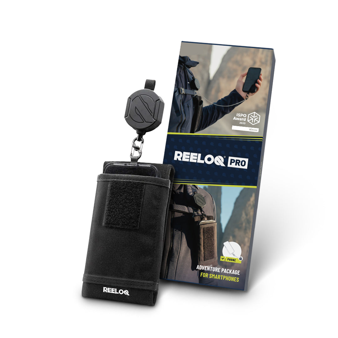
Reeloq Smartphone Securing System
If you want to take great photos on a via ferrata without worrying about losing your phone, Reeloq is the best tool for it. It’s a smartphone-securing system that allows you to use your phone on any adventure. This has been a great addition to my tool arsenal.
Shop on: REELOQ
So …. we just completed this. A few words of warning:
1. Our bad for trusting some random internet “expert.” This was nothing like it was billed. We have hiked all over the world (Sierras, Rockies, Zion, Teton, Glacier, Yellowstone, New Zealand, French/Swiss/Italian/Julian Alps), and this is the closest we have come to dying.
2. It is not 4.7 miles and 1,700 feet of gain. Our Strava showed 8 miles and 4,500 feet of total gain.
3. It is not “4-5 hours.” It took us close to 9, and we are considered “fast” hikers in the States.
4. The via ferrata sections are actually not too difficult, but the rest of it is definitely an advanced hike (10 out of 10), with some highly exposed sections washed out, a few of the cables pulled out from the rocks, some sketchy parts that probably should be via ferratas but aren’t, one part of the trail with a barrier closing it, some poor trail marking in a few sections, and zero flat sections. It’s all either very steep up, or very steep down. You climb or descend all day.
5. We did it in reverse (riding the chair lift up first and hiking toward Rifugio Auronzo. We started at noon and arrived at 9 pm. The last 90 minutes was on a ridge in rain and close to zero visibility. The last hour was in pitch darkness, using a headlamp and cell phone flashlights, trying to follow the trial that disappeared in sections. We finally arrived at Rifugio Auronzo after the last bus had left. The staff at the rifugio was not compassionate or helpful at all, and none of the staff was driving down for the night. Our option was to take a ride to the toll gate (about 1/3 of the way down) from a very kind but very dunk Irishman in thick fog; stay at the rifugio for 70 Euros each in a bunkhouse without sleeping sheets; or hike down the 20k windy road at night to our car in Misurina. We started hiking, and luckily a group of tourists descending well after hours took pity on us and drove us the rest of the way.
7. One of the people who drove us down say he’d had done the hike a couple summers ago but stopped for the night at the hut midway through the route, adding: “You’re crazy to try the entire thing in a day.”
9. It is unethical and borderline negligent to list this hike as “beginner” in any way, shape or form, or at least not to warn people about its length and dangers. I appreciate people on the web trying to help fellow hikers, but only when they’re competent and don’t put people at risk. Trust any hiking info from Marta at your own peril.
Hi Mark. Thank you for sharing your experience. I’m sorry to hear that the via ferrata did not go as you had hoped, and especially about the poor treatment you describe at Rifugio Auronzo. However, I do want to clarify several points because I think your comment attributes several things to me that are outside my control.
First, I did not list this as a beginner hike. It is listed as a beginner via ferrata. Those are two very different things. Even a beginner-rated via ferrata is significantly more demanding than a hard hike, which is precisely why via ferratas require specific equipment and experience.
Second, I did not come up with the statistics for this route myself. The distance, elevation gain, difficulty, and other figures are the official statistics provided by the hiking website and are based on my GPX data, which are calculated using topographical maps. I have personally completed this via ferrata in a single day, and the route can also be cross-referenced with the Cicerone Guidebook. So the information was not simply something I estimated or invented.
From your description, it sounds as though the conditions on the ground were significantly different from those at the time I completed the route and published the post. You mention getting lost multiple times, trail erosion requiring rerouting, barriers blocking parts of the trail, and what appears to have been landslide damage. Unfortunately, landslides and trail erosion are common occurrences in the mountains, and routes can change considerably as a result. At the time I published the post, these issues were not present. I also clearly state in my disclaimer that the information is believed to be accurate at the time of publishing.
Regarding Rifugio Auronzo, I genuinely am sorry that you were treated poorly. However, I’m not sure why that experience should be attributed to me. From what you describe, you were offered shelter for the night but declined because you wanted to return to your car. The mountain huts do not generally provide sheets; they provide basic blankets. Nevertheless, you would have had shelter and warmth for the night, which would have been the safer option given the circumstances you describe.
There also seem to have been several decisions made during the hike that contributed to the situation, and unfortunately your comment places no accountability on those decisions. Leaving at midday is very late for a route of this nature and leaves essentially no contingency time if something goes wrong. From your description, it also sounds as though you did not have a map with you. Given the slow progress, deteriorating conditions, and a poor weather forecast with rain, continuing all the way to the end rather than descending earlier seems to have significantly increased the risk.
For example, from Rifugio Fonda Savio, there is a clearly marked descent into the valley shown on the map, which would take approximately an hour to reach the next bus stop. That would have provided an opportunity to safely end the route rather than continuing despite the deteriorating conditions.
I completely understand that emotions were probably running high after a difficult experience on the via ferrata. If the trail conditions had changed or the information in my post was no longer accurate, that would be useful feedback, and I would be happy for readers to be aware of it and include it in the post. However, calling me “incompetent” is neither fair nor constructive.
I put countless hours into researching, completing, and maintaining this blog, and all of the information is provided freely. I make every effort to ensure it is accurate when published, but I cannot control trail erosion, landslides, changing mountain and weather conditions, closures, or decisions made by others during a hike. Nor can I reasonably take responsibility for decisions made on the route after conditions have changed.
I hope you are safe and well after the experience, and I’m genuinely sorry that your day on the mountain turned out the way it did. I hope the rest of your holiday was great and that you had a great time regardless.
Hi,
Is this really an easy route? I was planning to take it from Rifugio Auronzo down to Lake Misurina, but I have my doubts about how difficult it is – for example, Komoot warns of some very challenging sections. Have a nice day!
Hi Eryk. Komoot rates this route as a hike, they don’t have via ferratas in their options. Any beginner via ferrata will be more difficult than any hike. Beginner via ferrata can be considered as a T4 difficulty trail or in other words a Black Trail. Again this is a beginner via ferrata not a hike, so you do need via ferrata equipment to be able to clip yourself onto the cable protected sections. I hope that clears it up.